Ghost Waters Revealed
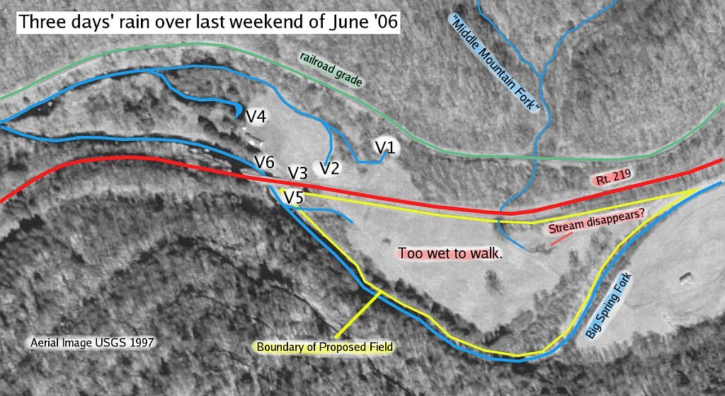
Below is a map showing the shooting locations of the six videos. Clicking V1-V6 on the map will take you down to the corresponding video where you can download/watch it.
In addition to the V1-V6 markings, note the "Middle Mountain Fork". The double quotes are because it is my name for it. On USGS topographic maps, it has no name. To the Army Corps of Engineers, it does not exist. Because of this, the Corps deemed the stream's impact upon the proposed site to be negligible. But note how it crosses directly through the path of the proposed site—and looks to disappear straight into the ground.
I find the negligible impact of this nonexistent stream to be disturbing.

Click here for a larger, more legible version.
In an earlier blog entry The Ghost Waters' Wrath, I wrote of my impressions and concerns as I walked the site of the proposed field and surrounding Big Spring Fork, which was dry at that time.
Around the last weekend of June, roughly a week after the above visit, Pocahontas County had 3-4 days of steady but unbroken rain. This brought some minor flooding to parts of the county, including Slatyfork.
A day or so after the rain stopped, I decided to return to Slatyfork—to the proposed field and area—to have a look and see how much water there was. And while the water levels had receded a fair bit, there was still a surprising amount to learn from what water remained. And most importantly, from where the water was coming.
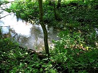
During an earlier tour of the then-dry area, I was shown the remarkable site of a dust-dry weed-laden hole going into the side of Middle Mountain. What at that time resembled a cave-like burrow proved to be quite more during this rainy period. The video V1 (click on small or large to the right) shows this same hole for what it really is: one of many conduits taken by the Ghost Waters. More precisely, it is a boil hole.
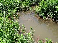
The video V2 also portrays a different story than when things are dry. On that earlier trip, this hole right in the middle of the field adjacent to the proposed site was dusty and angled. Like a groundhog hole, for a 300-pound groundhog. At that time, standing near to its entry was eerie. I kind of had a feeling that in fact some large monster would snap up out of it and end me right there. I also felt like I might just as easily slip in and disappear. But standing here now after a few rainy days, it was clear enough what kind of beast springs forth from this boil hole and runs unchallenged through the field.
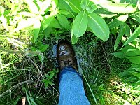
Moving just west a few paces, I thought I might try and walk through the field, along the left edge of V2's flow. But after just one step heading down into the tall grass, it was evident—as V3 shows—how super-saturated and pond-like this field had become.

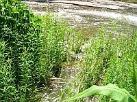
Giving up on that route, I walked a safe path behind Evva Shelton's place towards the wondrous Evva Shelton Spring (V4), as it's called. Pretty much directly behind Ms. Shelton's home, this jewel is out-of-nowhere and is just as fascinating as can be. On my earlier visit when the other boil holes were dry, this one was amply flowing—it is usually always flowing, even when Big Spring Fork itself is dry. And on this rain-recovering day, it was flowing strong and glistening as the birdsong does tell.
The actual field which is the proposed construction site for the sewage treatment plant is just across Rt. 219 from where most of these videos were shot. Quite simply, it was much too wet to walk the proposed site, even with water-proof boots on. But I wanted to capture on film some idea of just how wet the proposed field was, so I managed to navigate to a bit of ground just off the bridge to the field's west corner. What V5 shows is a significant run-off stream, whose origin appears to be yet another boil hole, pouring into Big Spring Fork, more than a day after the rain had already stopped and skies were blue.
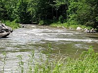
With just a little bit of memory left in my camera, I finished the day off with a brief shoot of the lovely Big Spring Fork (V6) as it exited from under the bridge and headed on towards Beckwith's and the Elk River.
It is amazing to me the dynamic nature of this stream and this karst system. One day all is dry and asleep. But the next, all is a unified and flowing reminder of the spirit of Pocahontas County. All is a soundful tide of memories and heritage, a receding yet vigilant ebb which begs us to pause, to consider what we have here, and of what we are so close to losing.
Copyright © 2006 by David March Fleming